
If you’ve seen one of the recent issues of The Phillips Collection’s Magazine, you may have noticed a wonderful article, “A Tour de Force”, written by Joseph Holbach, Chief Registrar and Director of Special Initiatives, which outlined the numerous Phillips exhibitions which have been traveling the world since the 1980s. Within the article was a graphical representation of the different tour “routes” to put it all into perspective.
Using that infographic and a simple jQuery plugin called Craftmap, we created a mini interactive that allows the user to zoom from one tour venue to the next, or even drag the map around to explore more organically. Best of all, since its jQuery and HTML, its mobile-device friendly! Try it out on the Touring Exhibitions page in the Collection section of our site!
We’re hoping this is just the start, as many of the works that have been on tour will be coming home in 2014, so developing some larger digital projects in conjunction with the upcoming exhibition, is being discussed. Be sure to stay tuned!
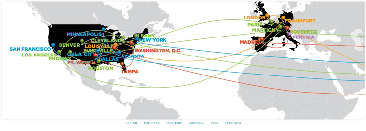
A map showing some of the locations of touring exhibitions over the past thirty-plus years.